
Panama Canal and Countries North
Panama Canal and Countries North
(Note: photos are all labeled, but the label only displays on an iPad or PC.)
October 2025
In October 2025 we took a 16 day cruise aboard the Royal Caribbean Radiance of the Seas from San Diego to Fort Lauderdale that went through the Panama Canal. The cruise got off to a rocky start. Actually, that should be a rocking start. From our departure on October 2 to our first port call at Guatemala on October 10, we had to zigzag between two hurricanes, Octave and Priscilla, then dodge the tropical storm Raymond. The first two scheduled ports, Cabo San Lucas on October 6 and Mazatlan on October 7 were both canceled due to our evasive maneuvers. We avoided the storms, but the resulting ocean swells were…well…not swell. As with other cruises when rough seas or weather occurred, it can sometimes be tricky walking down the hall and avoiding slamming into other passengers or a wall when the ship hit a big wave or swell. It was also advisable to avoid the passengers who looked more green in the face than red. (Funny statement. But only if you’ve ever read a Froggy book to a preschooler.)
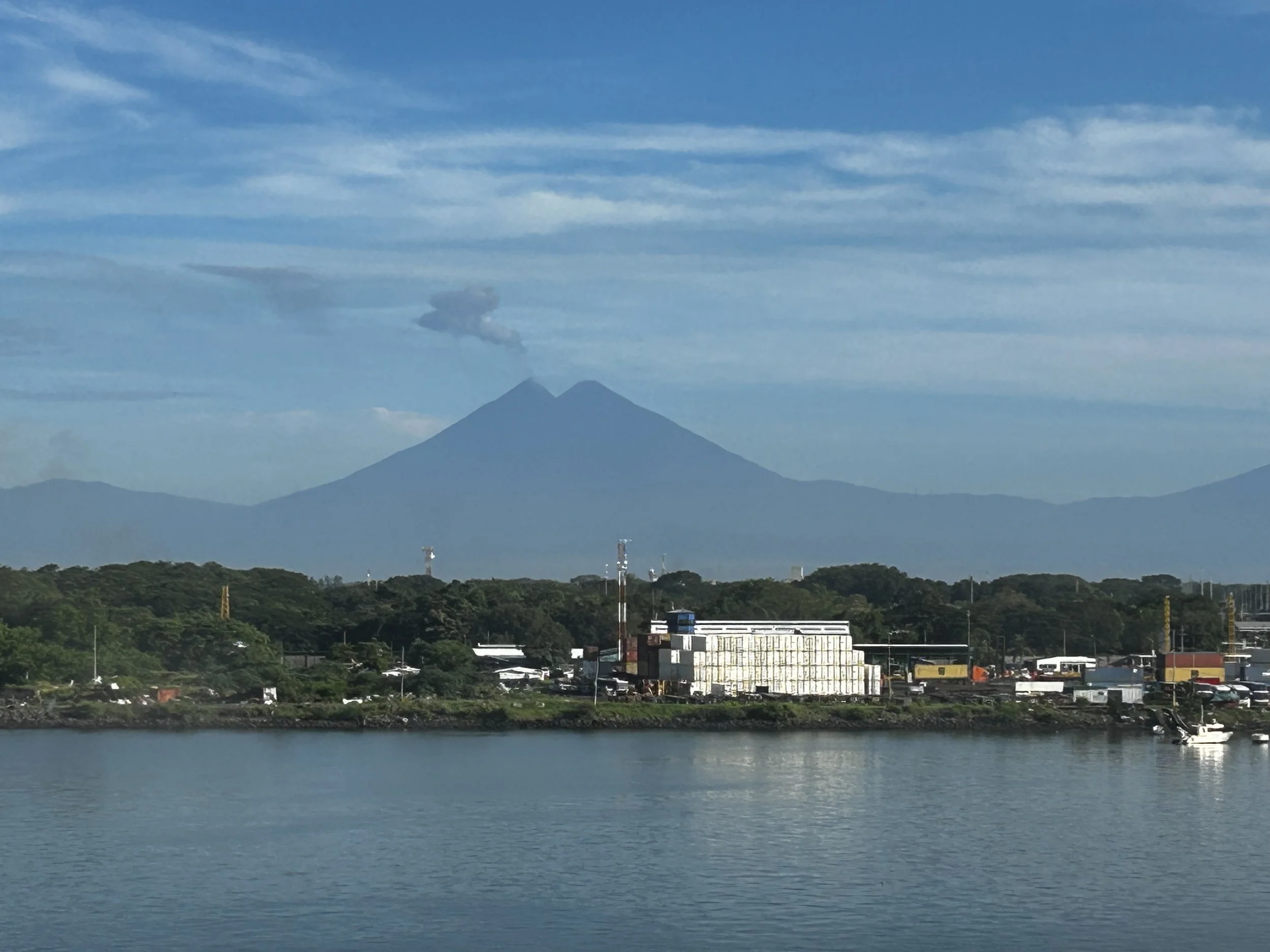
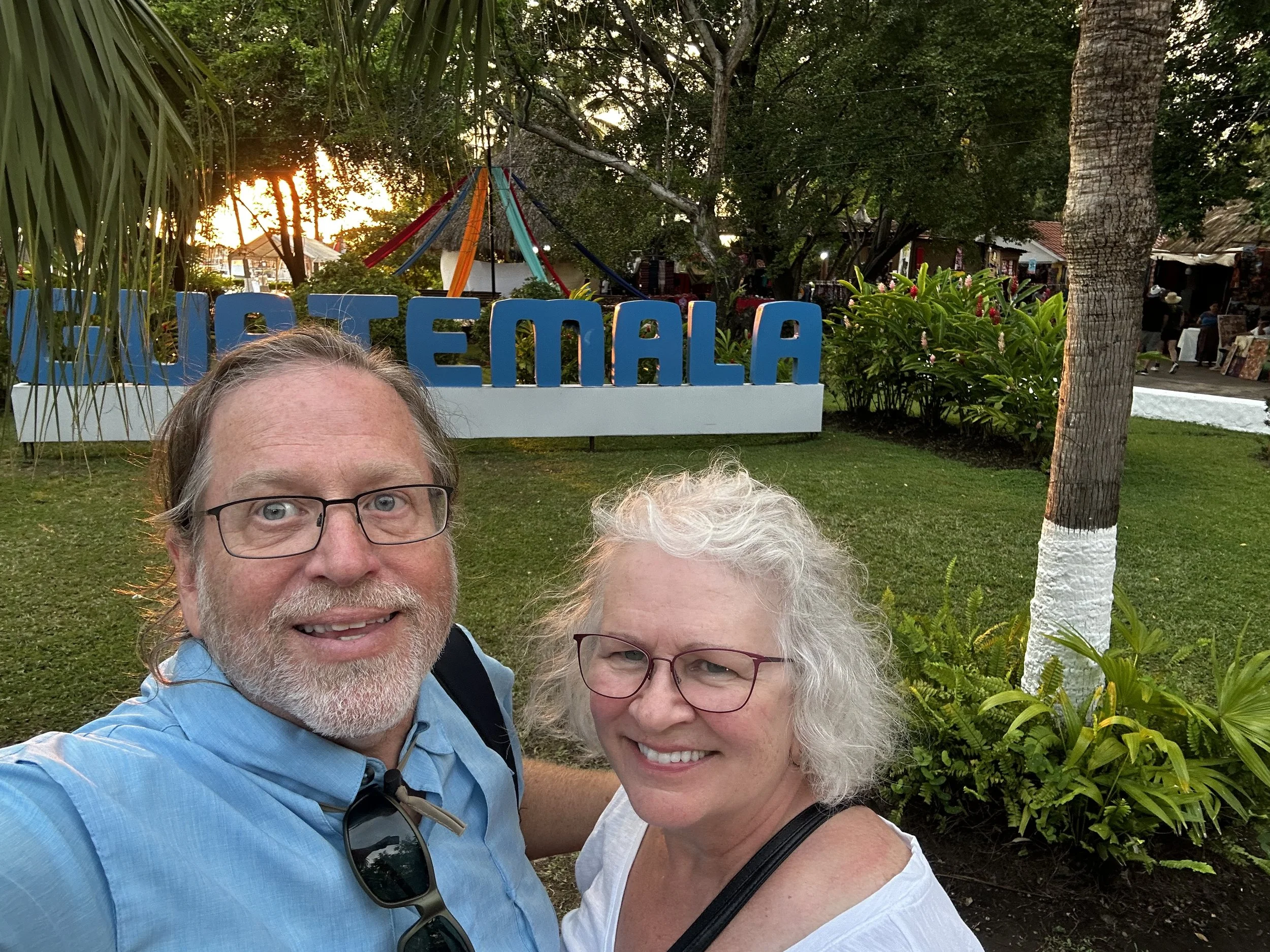
On Day seven, we finally made landfall at Puerto Quetzal, Guatemala! Our first excursion was to Antigua, located a couple of hours up the mountains. Guatemala is a small country, about the size of Tennessee, but with 37 volcanoes. We saw smoke rising from several of them during our drive to Antigua. Antigua is surrounded on three sides by volcanoes: Agua, Acatenango, and Fuego. (Names translated: Water, Wall of Reeds, and Fire. One of these does not belong!) Our guide provided comfort, letting us know that there had been no eruptions since Fuego erupted in June 2025. That made me feel much bet-----wait, only 4 months ago!!? She said it was no big deal – it would erupt and throw out some smoke and ash every couple of years, but kept all eruptions small provided they sacrificed an American into the volcano’s cauldron every year. She said it was very scenic from the rim and asked if I would like some locals to give me a free private tour. But I passed.
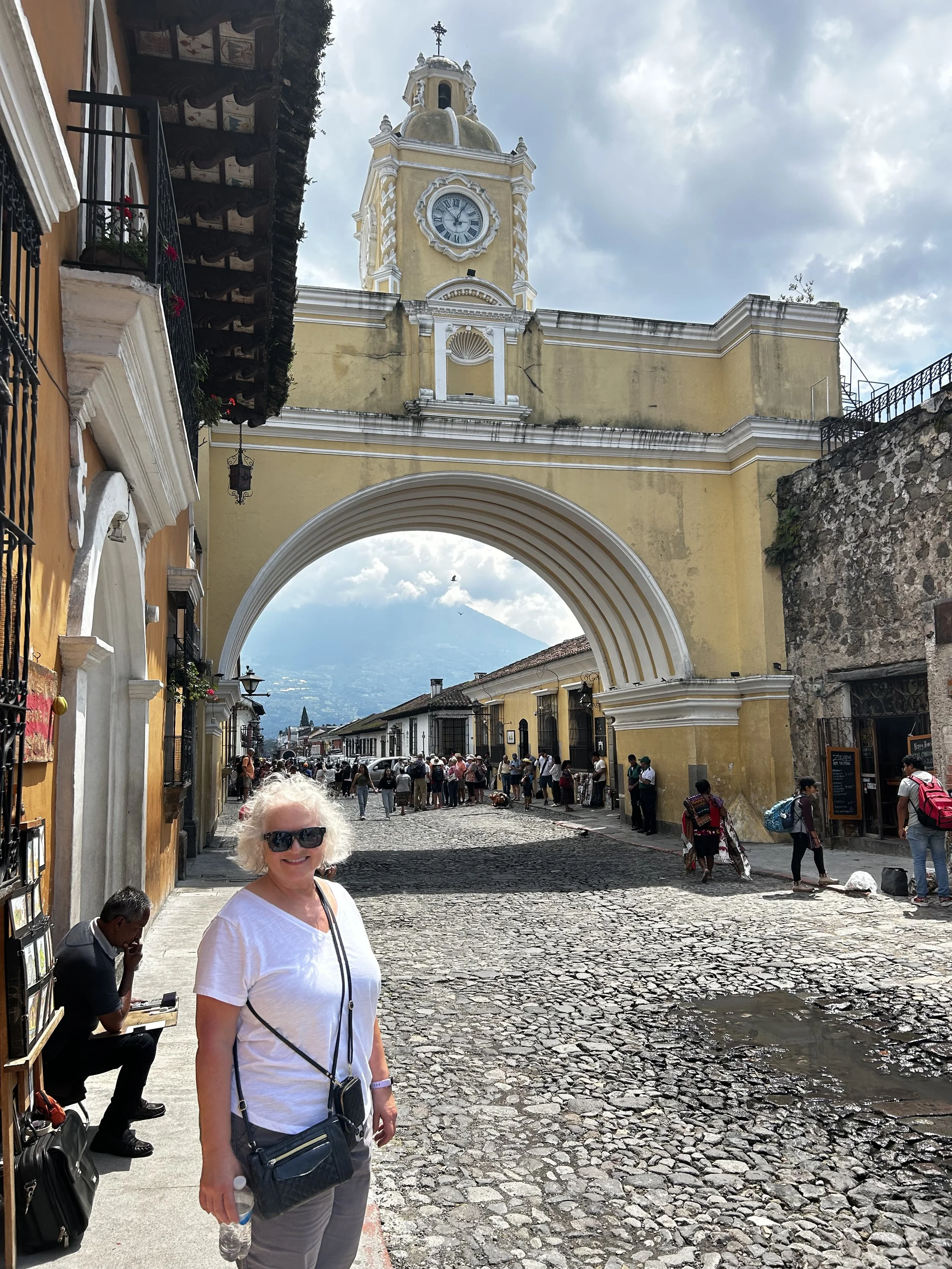
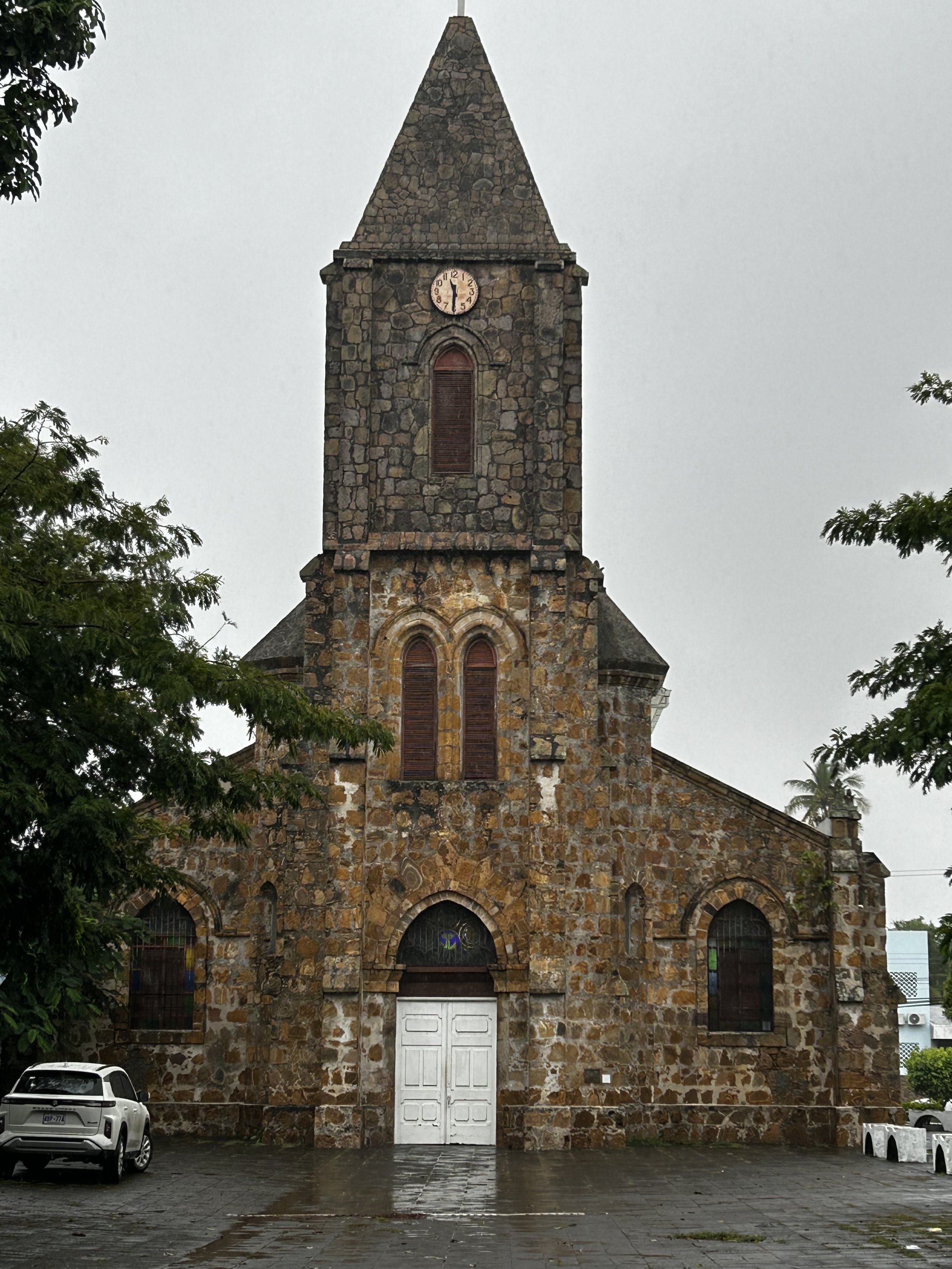
Antigua is a made up of Spanish colonial-styled buildings. They are very protective of their culture and require all businesses to fit the local architecture. American food chains are in abundance, but are required to comply. Without the huge traditional signage, I usually only spotted them when standing immediately in front. I spotted Little Caesars and Wendy’s but the standout was McDonalds. The McDonalds restaurant had an unadorned adobe front absent any huge golden arches but had a huge Latin-style outdoor garden courtyard in the middle of the enormous dining area with statues of McDonald characters and a playground for the kids.
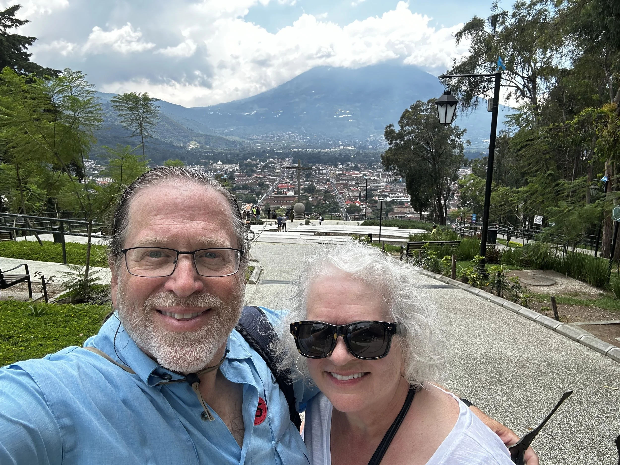
It is easy to navigate around Antigua, you just look for the smoke plume coming out of Fuego and get your directions from that bearing. Or you can use Google Maps. There is a cross high on a hill with scenic views of the town below. I pulled up Google Maps and followed the instructions winding around foot hills cumulating in an endless cobblestone street winding up a steep hill at a 30 degree angle. We were beating everyone up the hill – there were no tourists anywhere, just a few staring and befuddled locals at houses and shops as we huffed and puffed up by them. Then I looked at my phone a realized something really hilarious. I revived my red-faced panting Bride and told her I had accidentally selected the scenic driving route option on Google that had us circling around and coming in from behind and over the crest of the hill and not the direct footpath that only went partially up the hill. Ha ha! She didn’t think it was near as funny as I did and made some not very nice comments and threats that she intended to carry out on me, provided she ever recovered. I was elated when we finally came upon the cross and a bunch of fresh and rested fellow passengers from the ship. The view was spectacular and more importantly, I knew my Bride wouldn’t kill me with witnesses present. Antigua was a very scenic city in a beautiful valley. Go and see it before Fuego or one of the sister volcanoes destroys it.
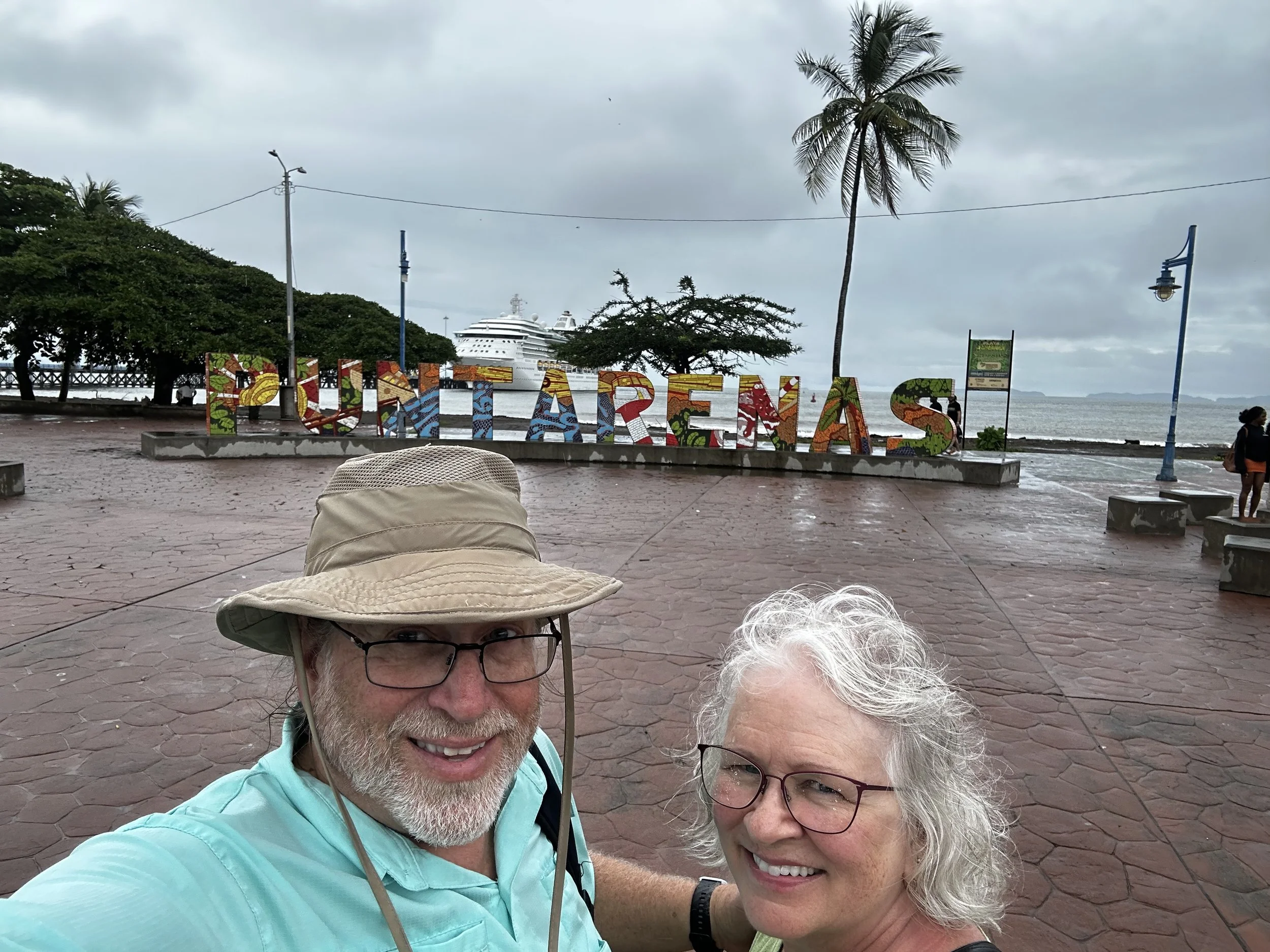
Next stop was Puntarenas, Costa Rica. We just walked the town, but it was more a working port town and not much to see. Looking back, I probably would have done a tour of the countryside since Costa Rica is such a lush country rich in natural resources. I need to return in the future, but after I notch visiting 100 countries. (Costa Rica is number 85.) One thing we did do was visit the market. I bought some excellent Costa Rican coffee that I’m enjoying as I type this. I do not understand what they do to coffee to get it to America, but I have never enjoyed coffee so rich as this Costa Rican coffee or coffee I have had in Colombia or Luanda, Cameroon.
Finally we made it to Panama and the canal. When I told people I was taking a Panama Canal cruise from San Diego to Fort Lauderdale, a few responsed: “Are you going all the way thru the canal? Because most ships just go into the canal and then turn around and exit so the passengers can say they went thru the canal.” These comments left me dumbstruck. Well, maybe the commentators were the dumb part. Did they think we would sail from San Diego, go into the canal, then turn around, exit back into the Pacific, and circumnavigate the South America continent to make the final port in Florida? Yes, we went all the way thru the canal!
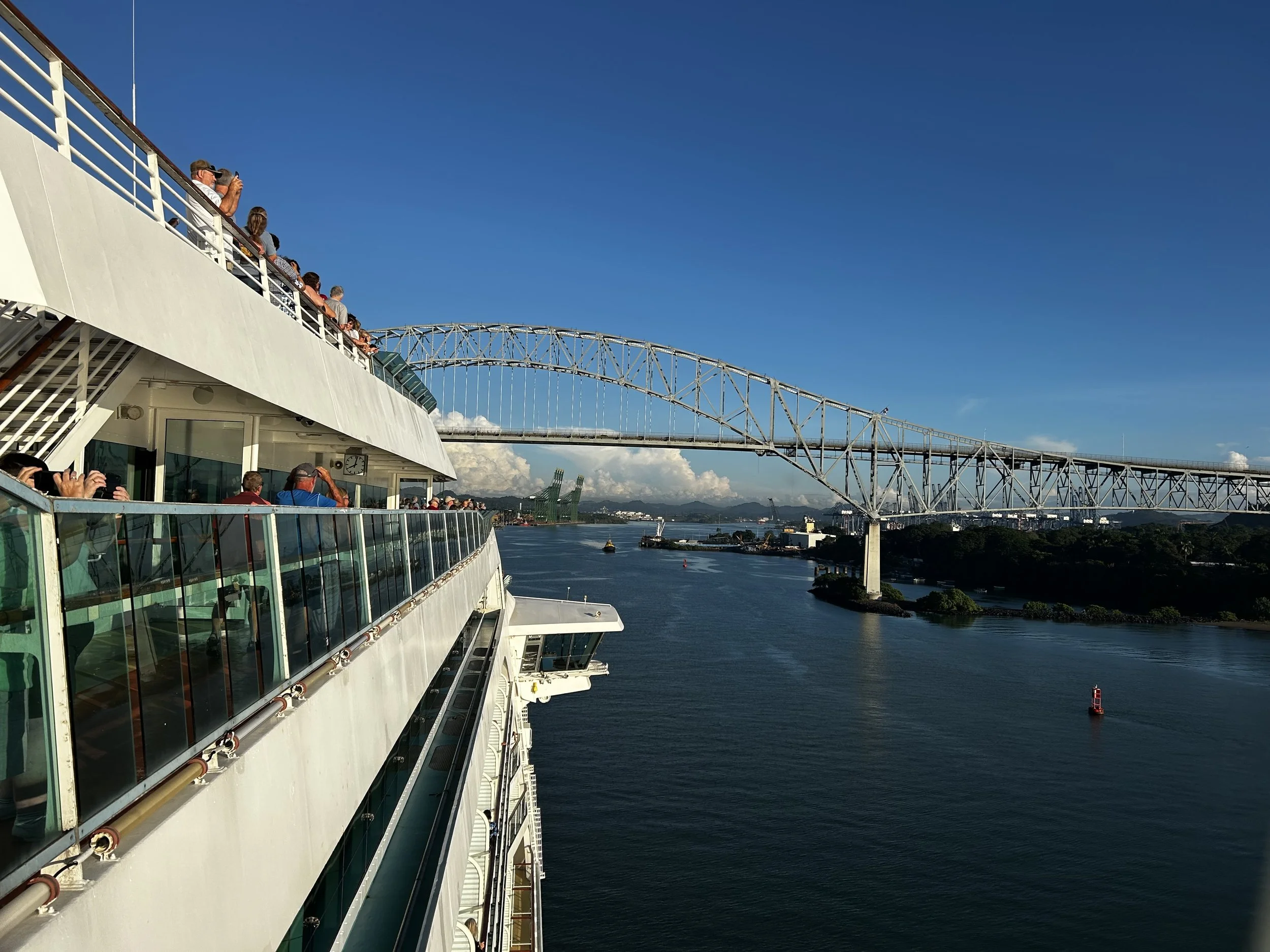
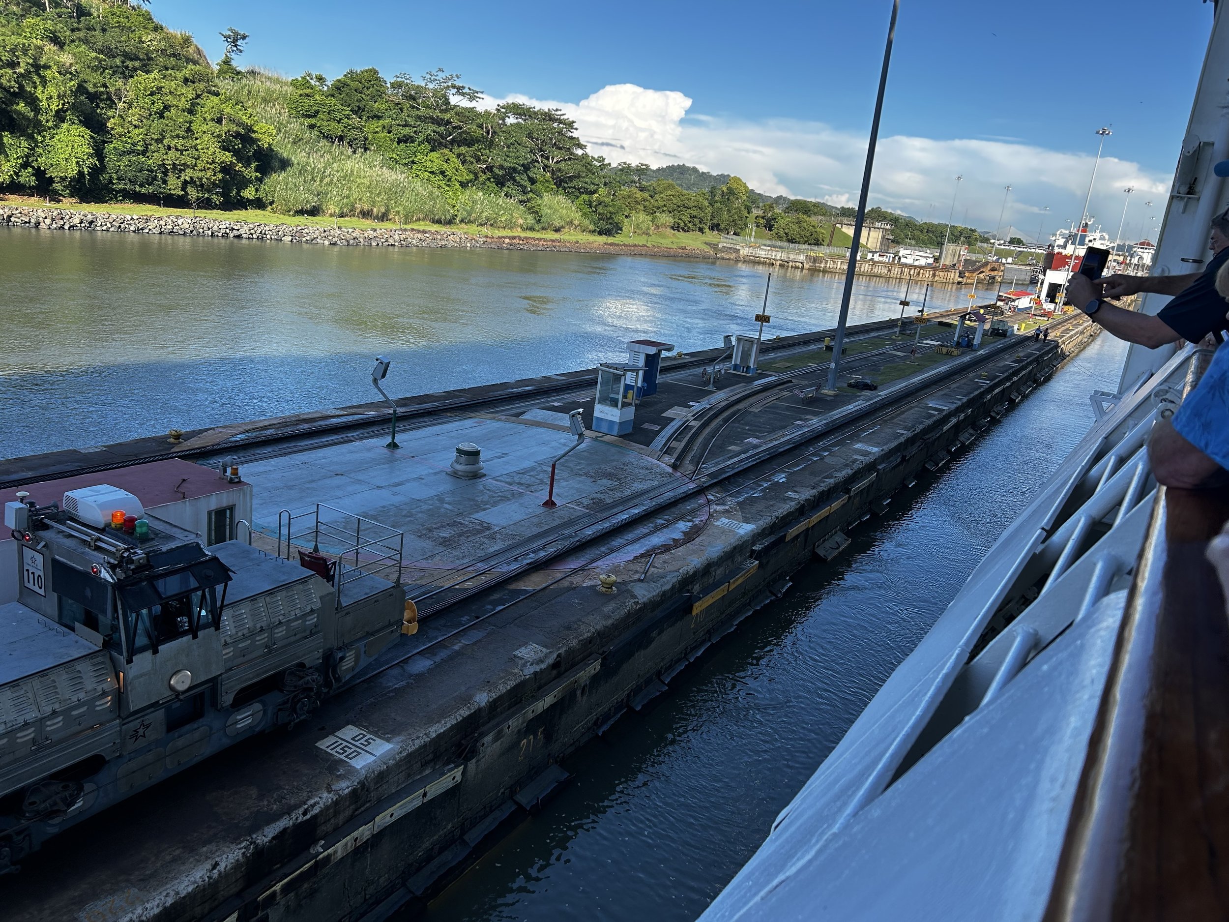
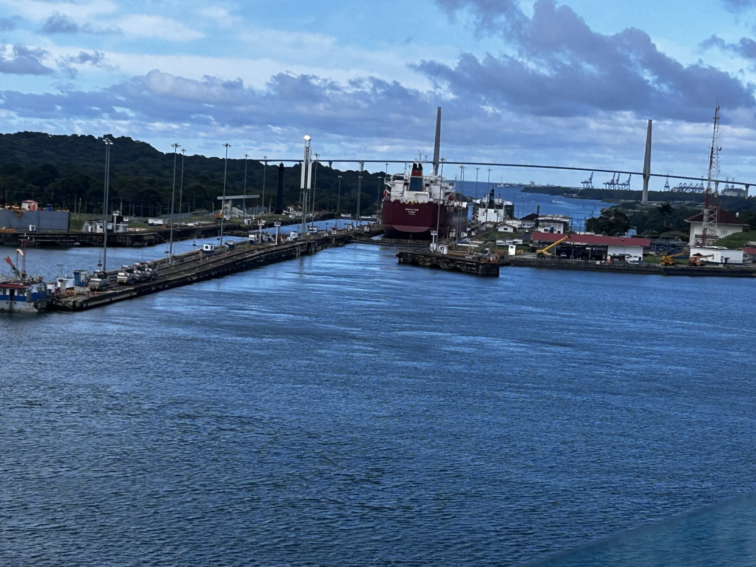
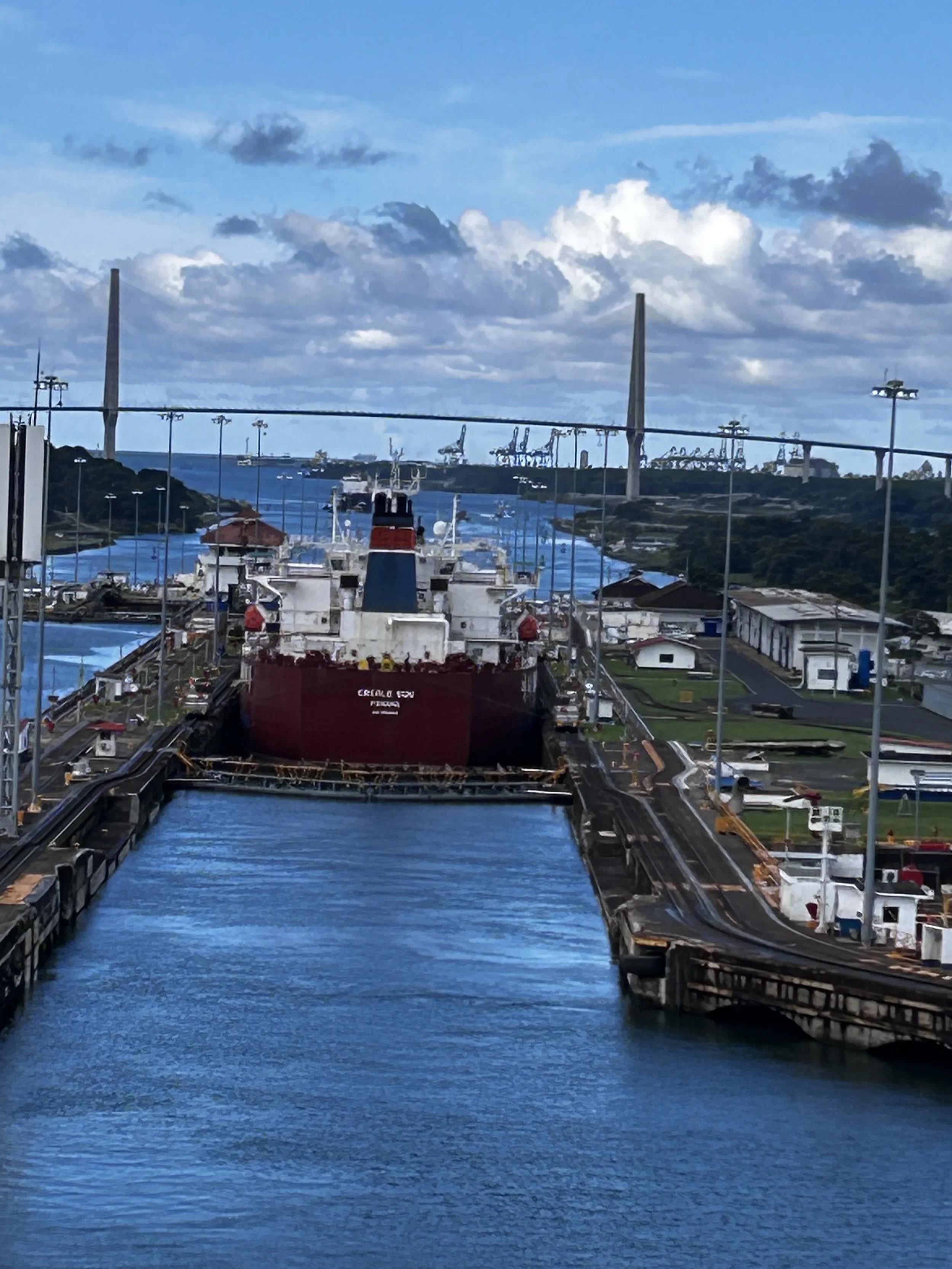
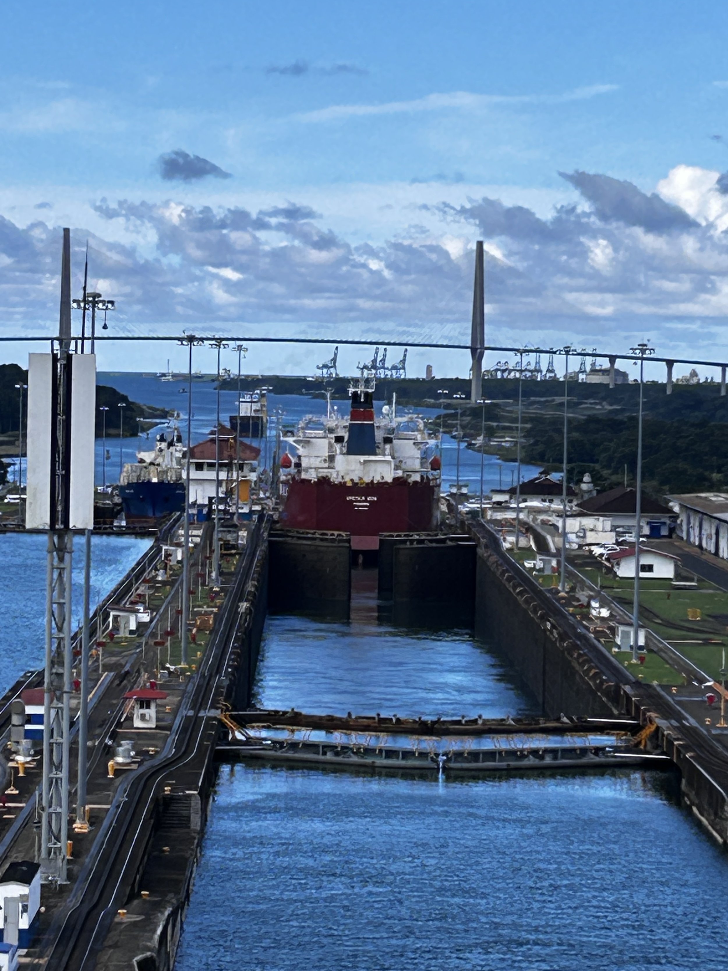
We had a couple on board that did destination presentations in the theater on sea days to let us know what to expect at each stop. We found out our ship, Radiance of the Seas, is a Panamax rated ship. That means it is classified as the largest class of vessel that can fit through the original canal locks. Panamax defines the absolute largest ship that can fit is 965 feet in length, 106 feet width, and 39.5 feet in draft. I Googled the Radiance and it’s measurements are 962 ft in length, 106 feet width and 28 feet draft. The original canal has six canal locks. The first three from either the Pacific or the Atlantic raise the vessel up so it is at the level of Lake Gatun and can cross the isthmus. Then when the ship reaches the other side, the last three locks lower you back down the level of either the Atlantic or Pacific. Cargo ships have continued to grow since the canal was completed in 1914 due to a healthy diet of shipping containers. As a result, Panama constructed 6 new locks that are about 50% larger completed around 2016. We went through the old locks.
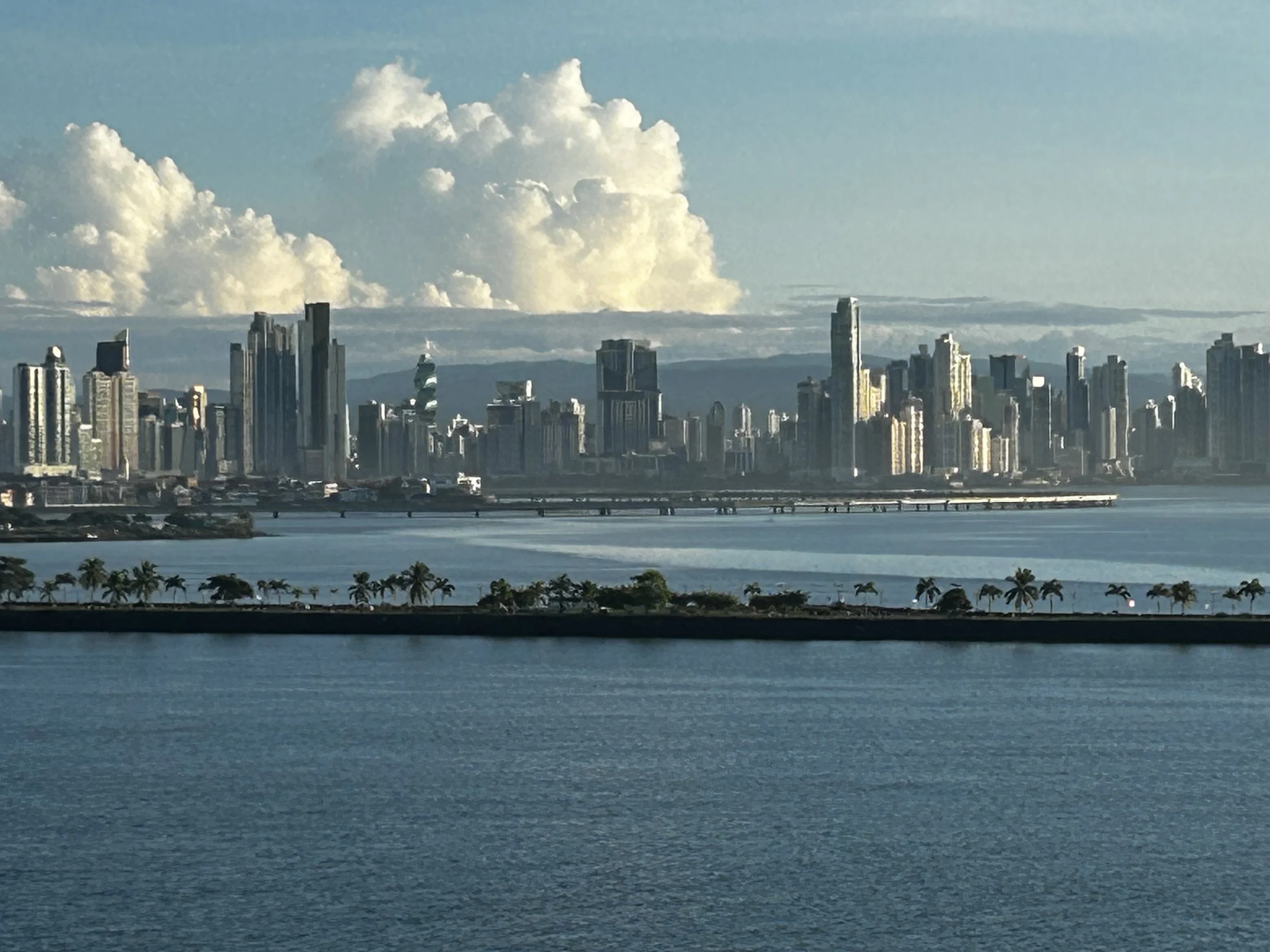
I woke up early to see us approach the canal. Panama City dominated the skyline to the north east. There were ships moored everywhere waiting to use the canal. The canal fees can be expensive and if a ship can wait for an opening in the schedule to develop, it can save them tens or even hundreds of thousands of dollars. Our ship paid about half a million dollars for the crossing. For that fee, they were reserved a specific day and time. Most cruise ships don’t transit the canal as part of their regular routes. But in the winter, and especially after hurricane season, the big money maker for cruise lines is the Caribbean, a primary destination for cold Americans. In the heat of summer, Alaska, Iceland, and Norway are hot destinations to cool off. Our ship spent the summer going between Vancouver and Anchorage. We actually sailed on this same ship in August 2024 in Alaska. So this was a once-a-year cruise to reposition the ship from the Alaska routes to the Caribbean routes. And for the Radiance, it was a sad last time to do this reposition for the fore”sea”able future – it was being taken off the summer Alaska route and stationed permanently in and out of Tampa Florida for at least the next two years.
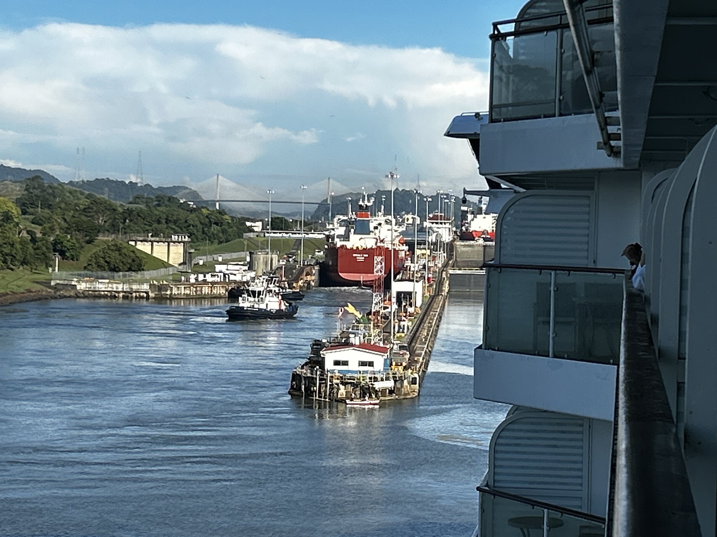
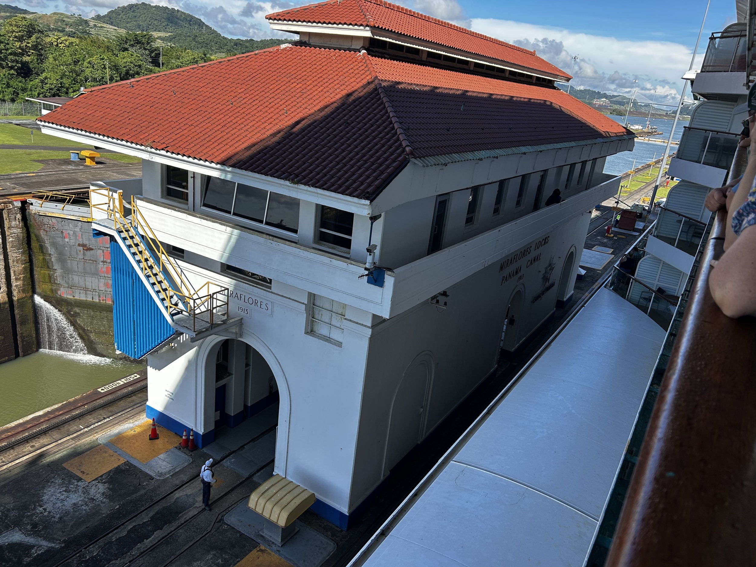
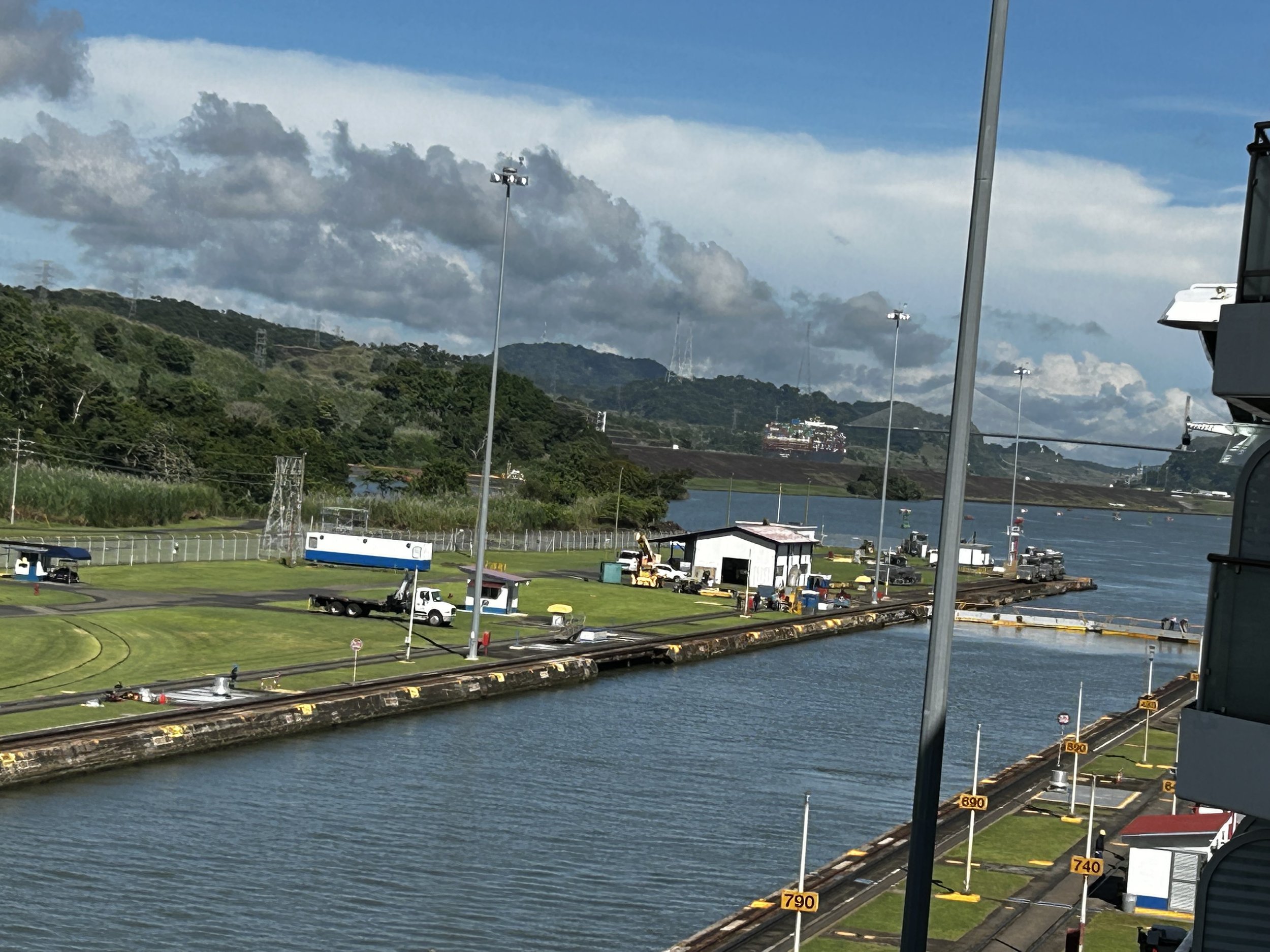
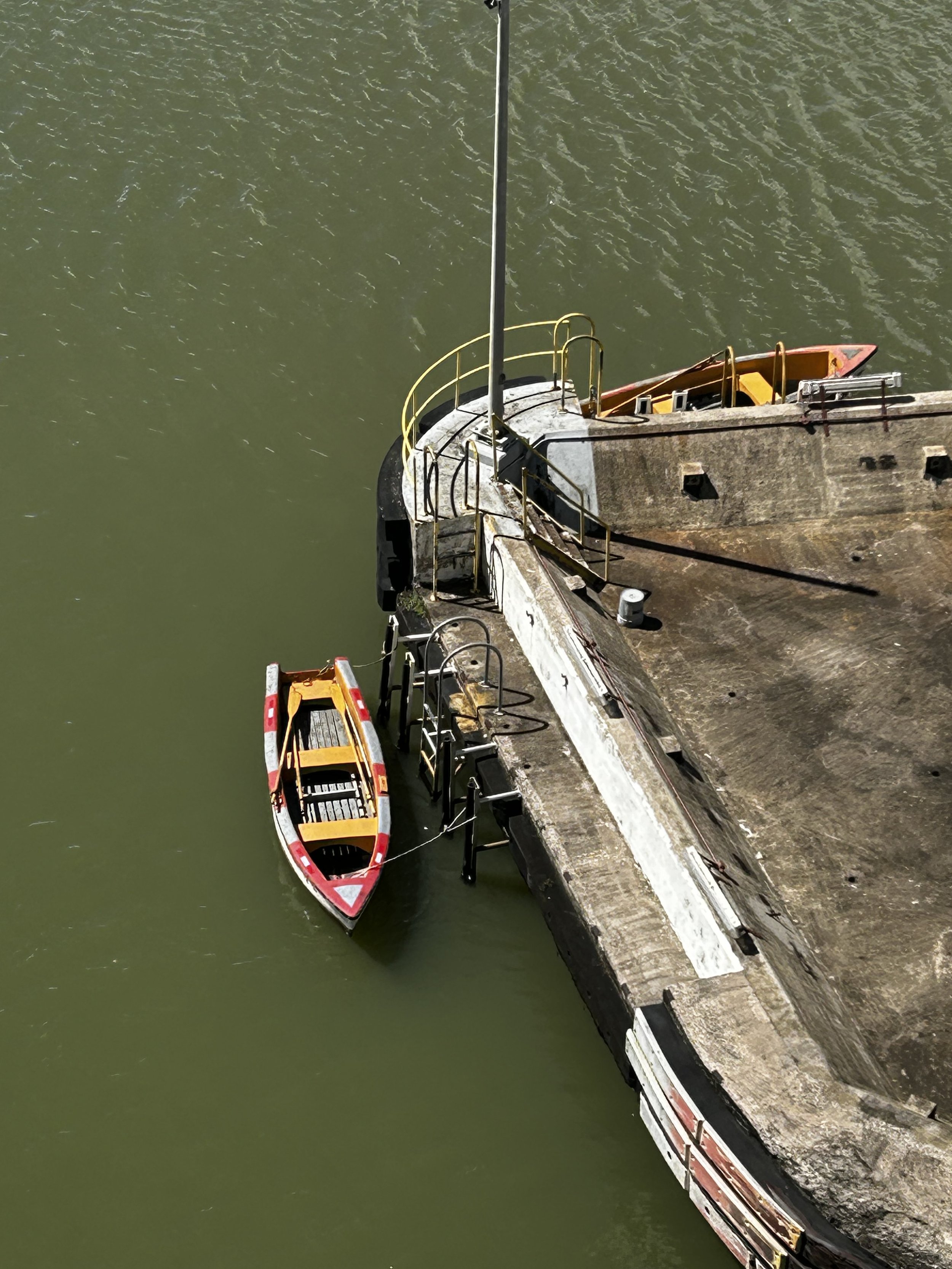
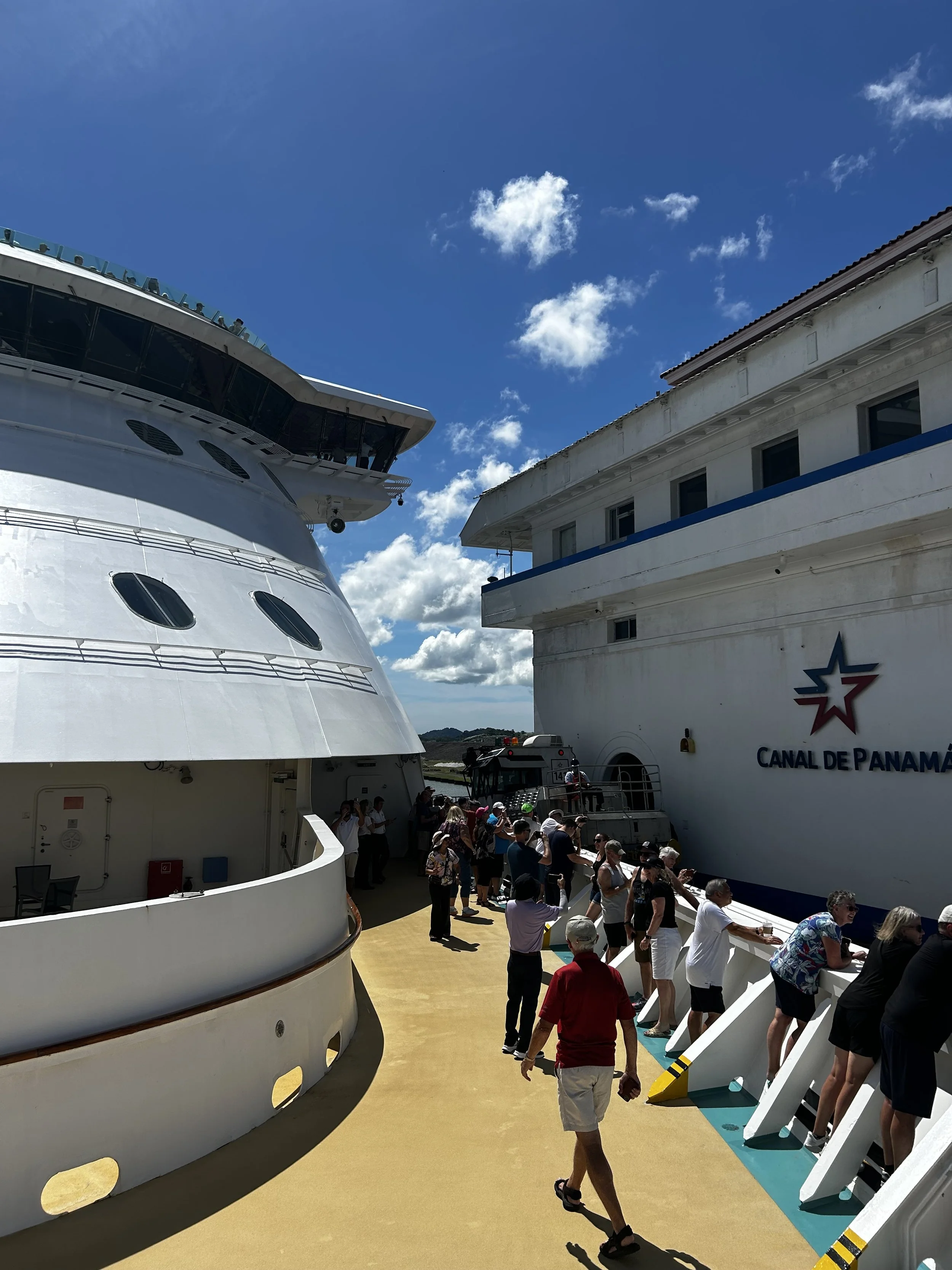
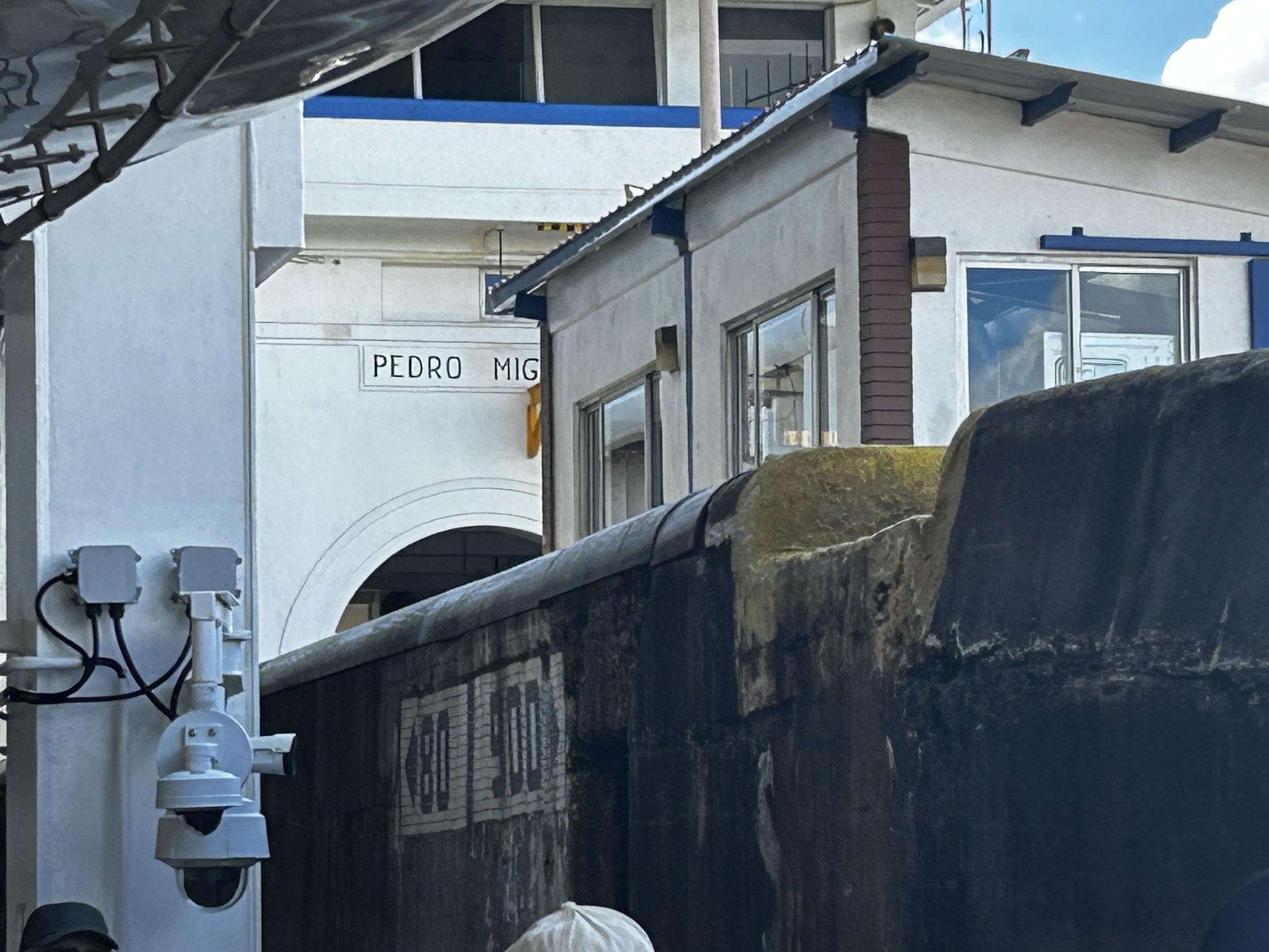
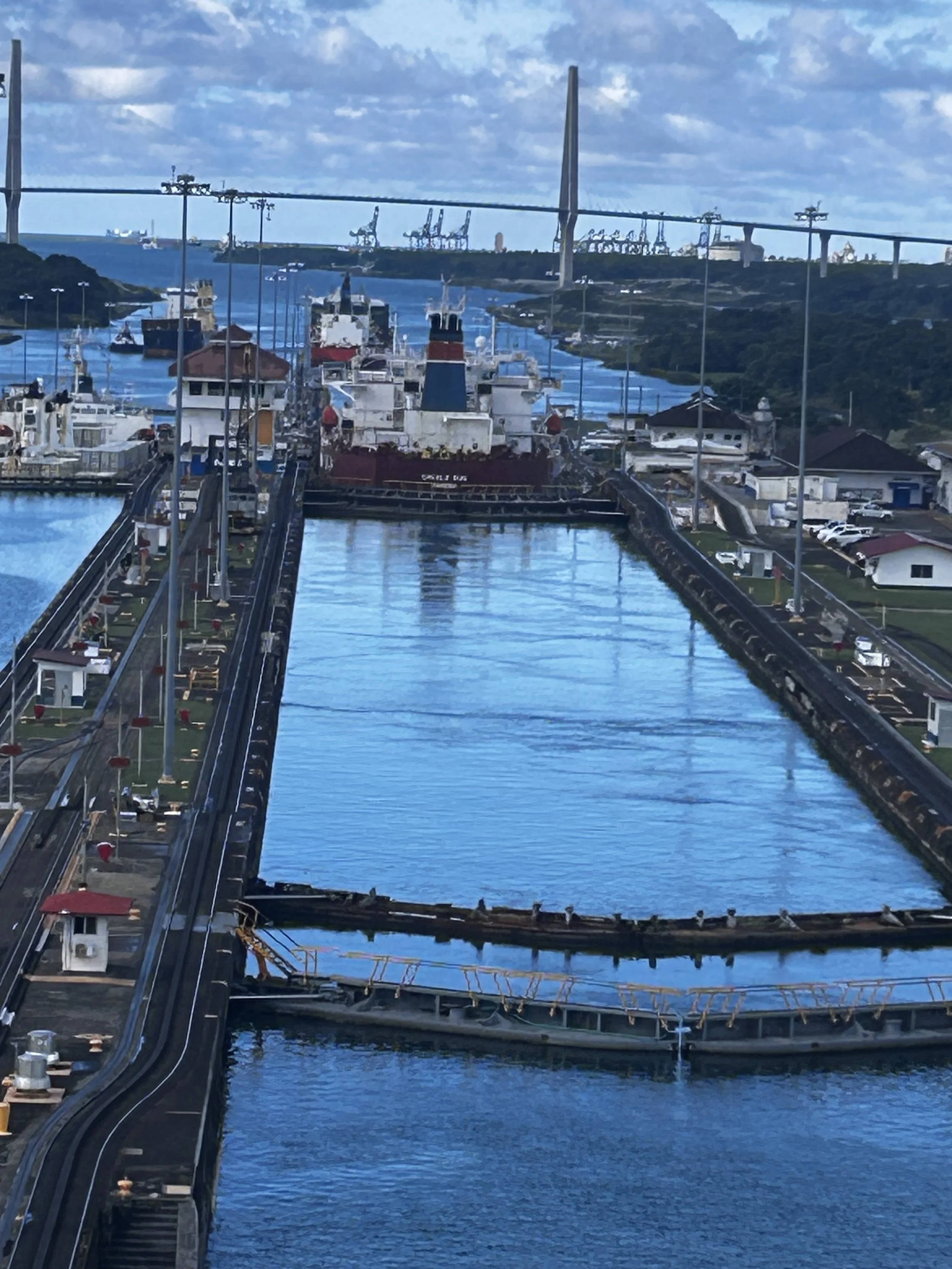
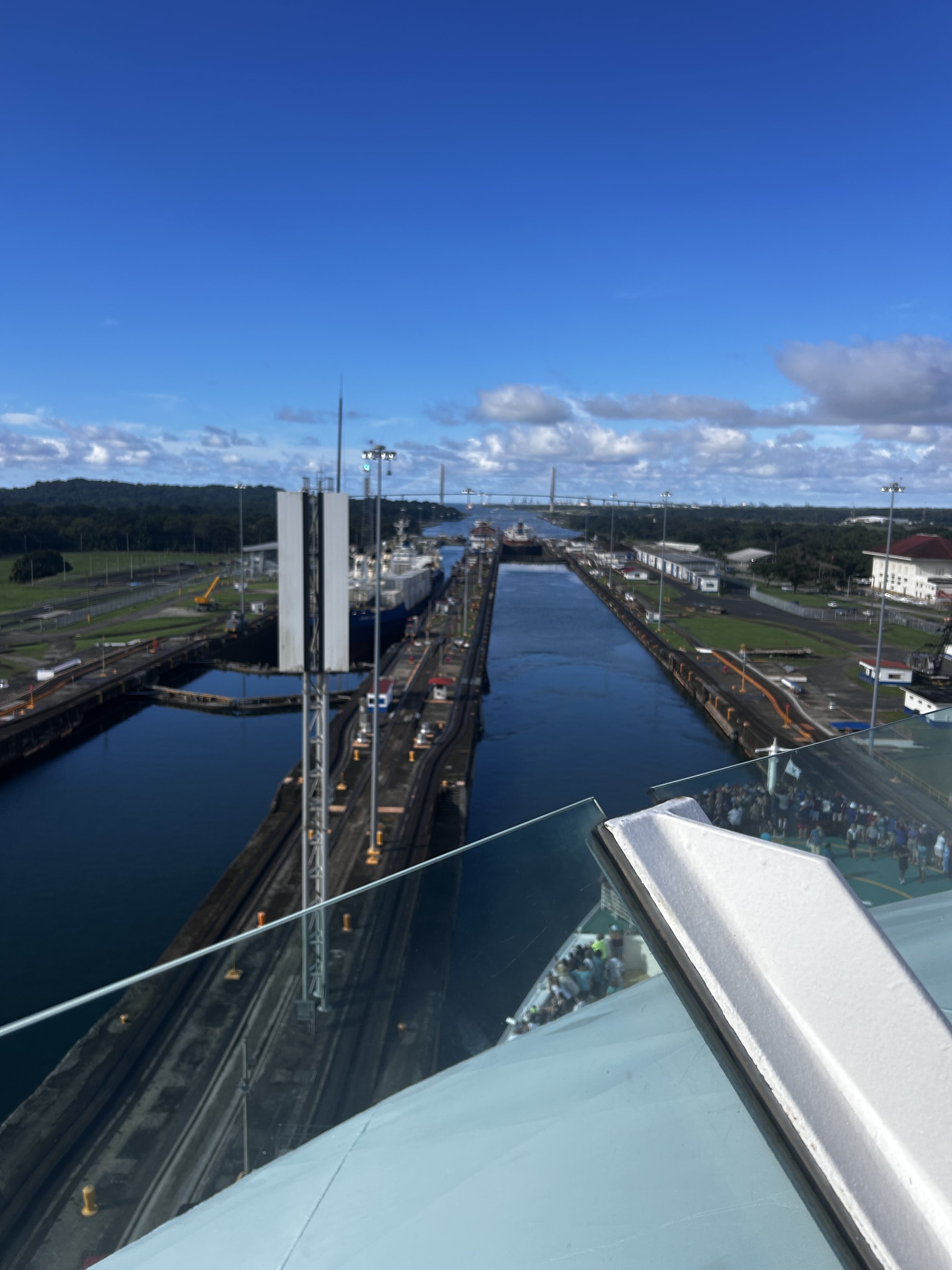
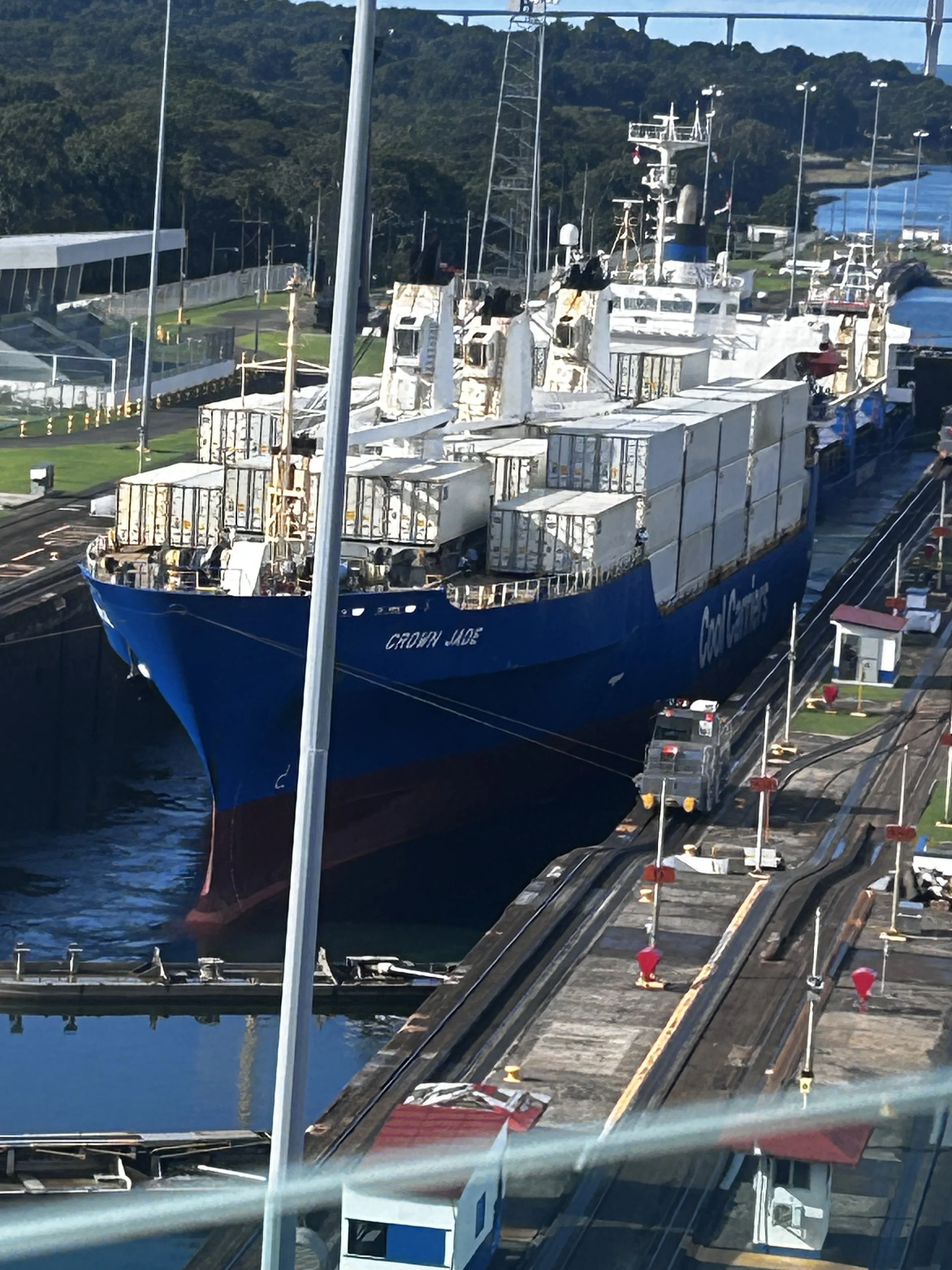
Just after sunrise we entered the first lock. The left side of the lock extended out into the bay. This allows the ship to have room to maneuver to where they are basically touching the left side. Get this, an old fashioned wooden rowboat with one person came out to get the tow lines from the ship and take them to the extended side of the lock where it is attached to the first mule. The mule is a 50 ton electric locomotive that moves on tracks down each side of the canal, carefully pulling the ship forward to the exact spot for the doors to close and the lock to be flooded, raising the ship. For a Panamax ship, eight mules are used, four on each side. And these huge locomotives are called mules because when the canal opened in 1914, actual mules (as in, “hee haw”) were used for this same process. The rowboat at each lock appears to be the original from 111 years ago. The pattern of the locks were two next to Pacific, one a few miles inland, then three in a row on the Atlantic side.
The sides were literally scrapping the sides of the ship. Not continuously, but the rubber lined side would start that squeal from time to time indicating contact with the ship. The mules would adjust tension on the tow lines and it would stop. From the outside promenade on deck 5, you could literally reach out and touch the walls as we entered. When the gates started shutting behind the ship so the lock could be flooded, it didn’t appear they would clear the ship in their swing they were so close. Remember, our ship only had three feet in total to spare. The flooding seemed slow just because so much water was needed. And it had to come in evenly, or it would shove the ship forward, backward, or into the side.
Three locks raised the ship a total of 85 feet. We then spent several hours sailing the canal channel and the Lake Gatun before reaching the Pacific locks. The Chagres River was dammed to create Lake Gatun and create close to half the navigable waterway; the challenge was the south mountains between the lake and the Pacific. Remember, this was 1904-1914 before you could ask AI how to make a river run through it. All they had was Google and questions had to be asked in Morse code. The equipment was either steam-driven or horse- and mule-pulled.
With the limited resources available to them, the Panama Canal is widely considered one of mankind’s greatest engineering marvels. And it was the Americans who successfully accomplished this feat. The French dug the Suez Canal in 1869 and thought they could repeat the task in Panama. But digging thru mountains is not the same as digging through the desert. Even worse, the jungle produced mosquitoes bearing malaria and yellow fever that killed 22,000 workers. The French were forced to surrender…er… abandon the canal work in 1889 after trying for eight years. The Americans had realized that mosquito-born diseases were causing greater casualties during the Spanish-American war of 1898 than fighting. So the US Army started addressing methods to combat mosquito infestations, such as draining of stagnant water, use of mosquito netting, and thicker clothing designed to reduce skin exposure. They brought this knowledge with them to Panama and it made the difference in success versus failure. Total casualties from all sources (including industrial accidents) during the 10 years the Americans worked on the canal were about 5,000.
Another factor in the America’s success was that while the Panama Canal was an extremely expensive endeavor, the US government was behind the effort. The French attempt was largely privately funded. There is a mountain (really more of a hill) that the canal goes thru that was named Gold Mountain. Investors solicited to fund the French attempt were told about the mountain and that they would have shares in any gold found. Gold was never found anywhere in Panama. This was well known by the mid 19th century and it is speculated that Gold Mountain was so named and the rumors of gold were spread by the French team trying to raise funds for the canal. Gold Mountain was pointed out to us over the loudspeaker as we sailed by. I had heard you could occasionally see crocodiles in the canal; I kept a vigil on shorelines with binoculars for most of the journey but never spotted one. Exiting the canal through the three locks on the Atlantic side was the reverse of the process on the Pacific side. Instead of entering the lock, shutting the gate and flooding the chamber to raise the ship, the lock was drained each time to the lower the ship.
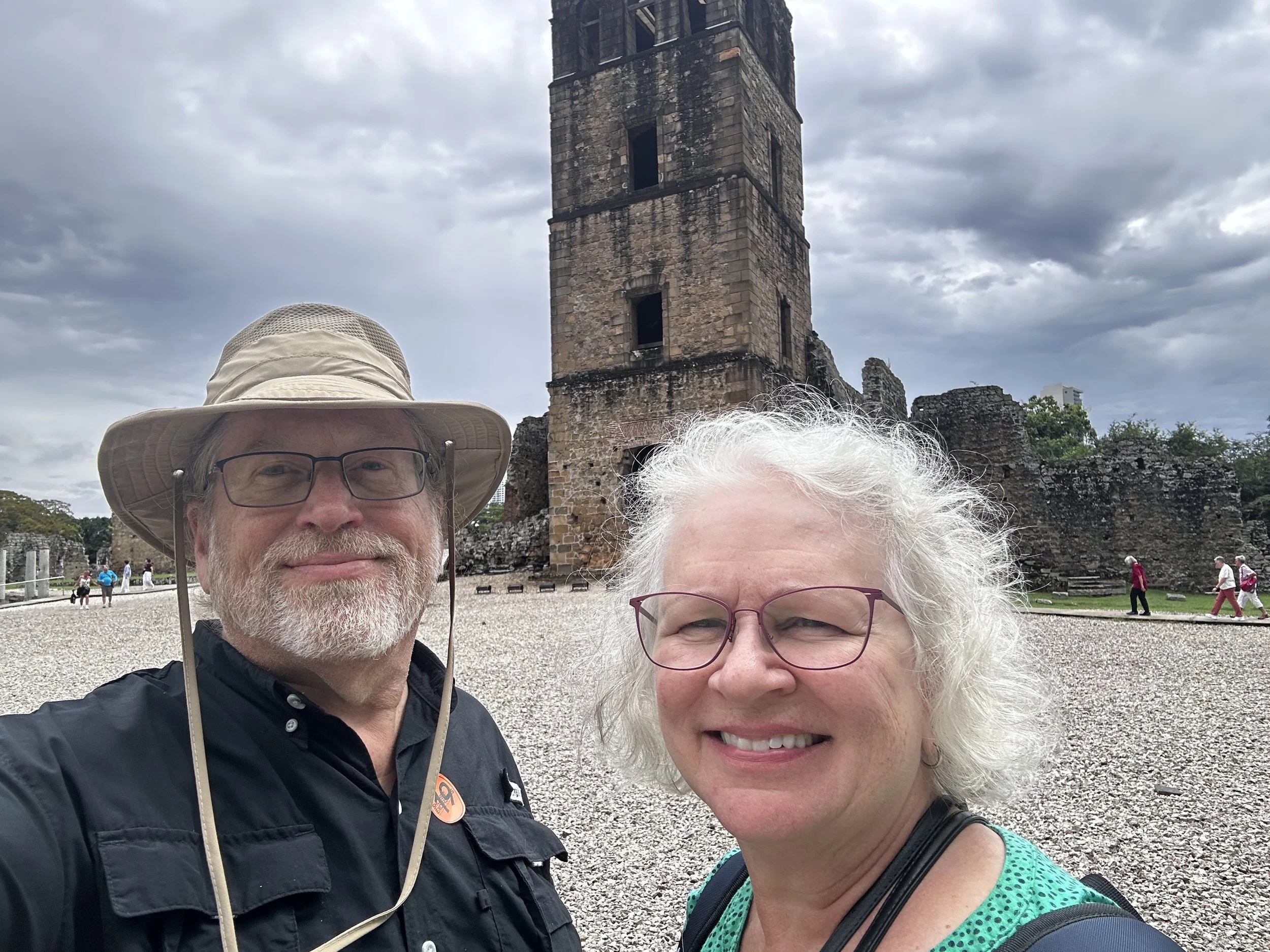
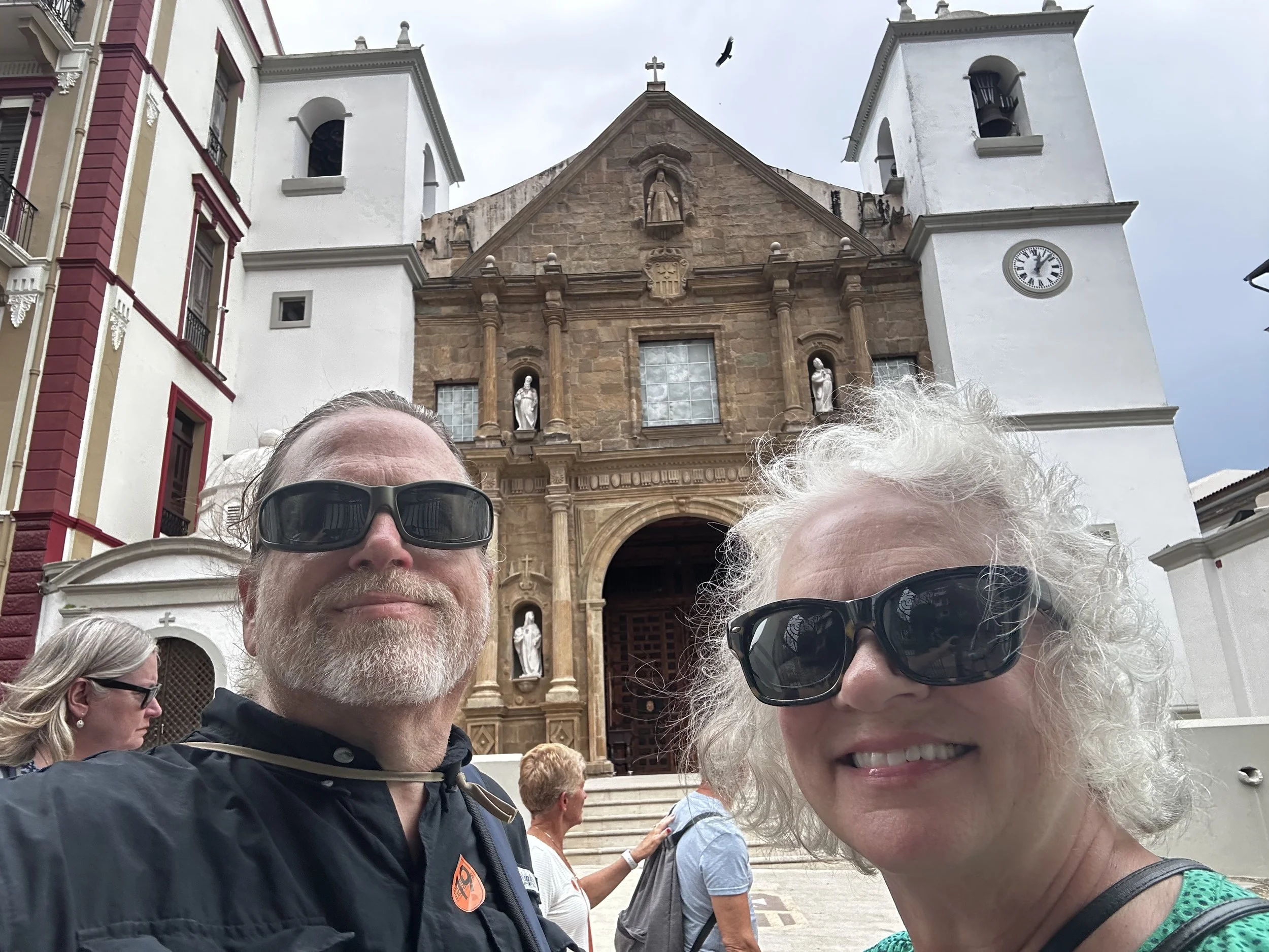
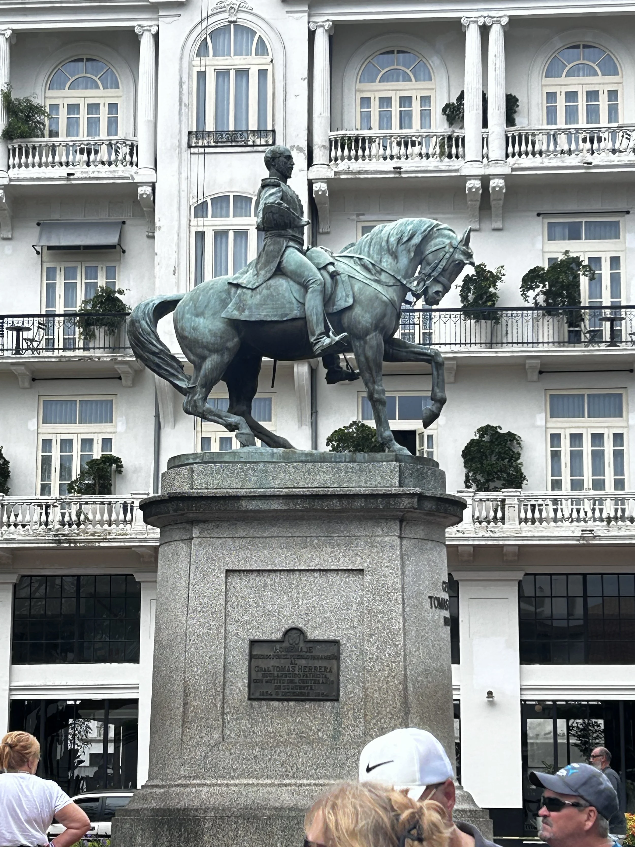
We made port in Colon, Panama. Who thought it was a good thing to name a town after a body part that is a holding tank for disgusting waste? Oh, they try to disguise it by putting that little apostrophe over the second “o” (e.g. Colón), but they’re not fooling me! So we took a tour all the way back across the isthmus (I never thought I would have a need to write isthmus, but I’ve used it this-much!) to Panama City. We walked the remains of the original Spanish settlement and a museum of the history of Panama and artifacts from the earliest inhabitants to the Spanish conquerors. We toured the colonial section of town where the government and embassies are located, then drove thru the modern skyscrapers.
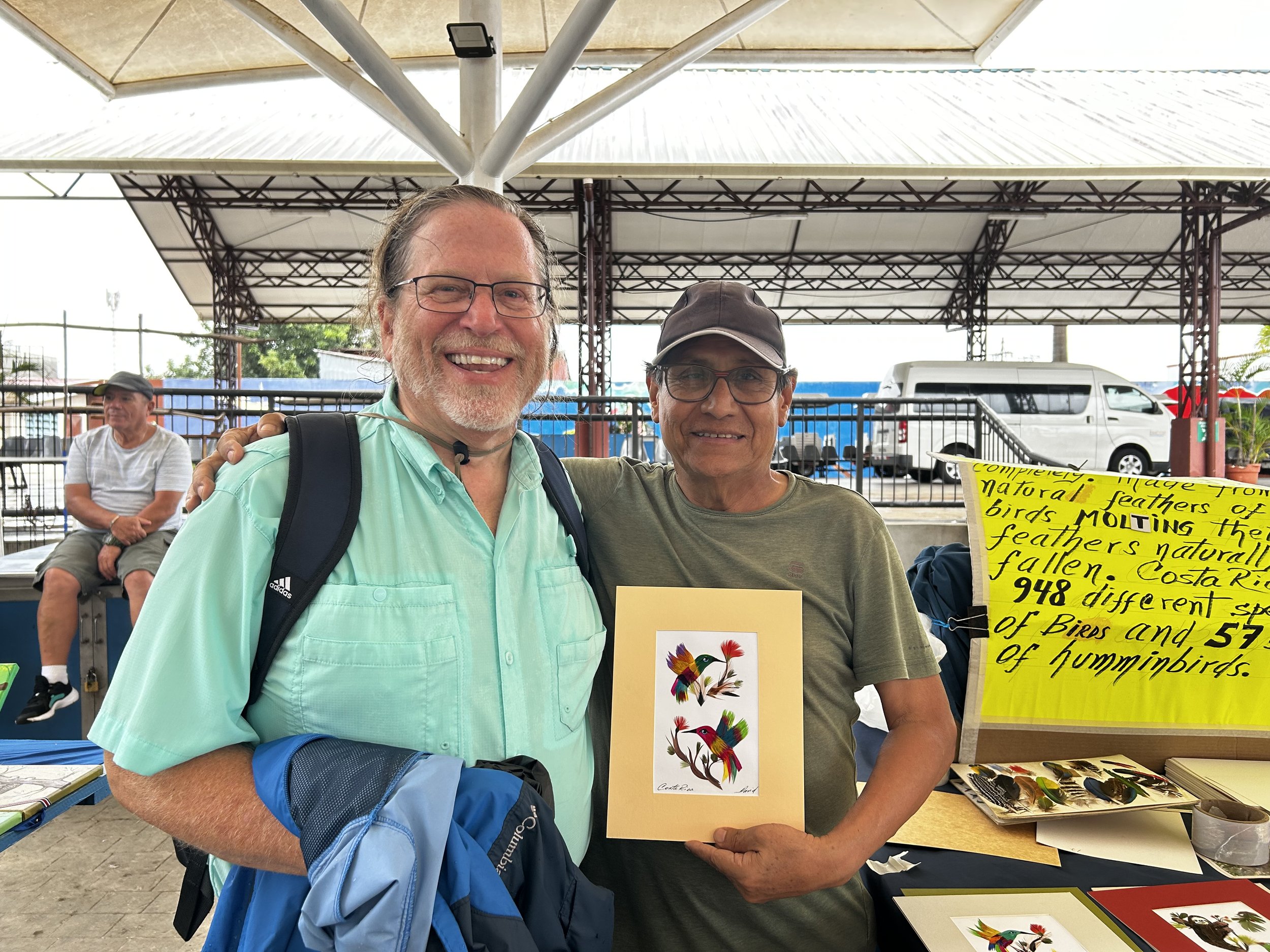
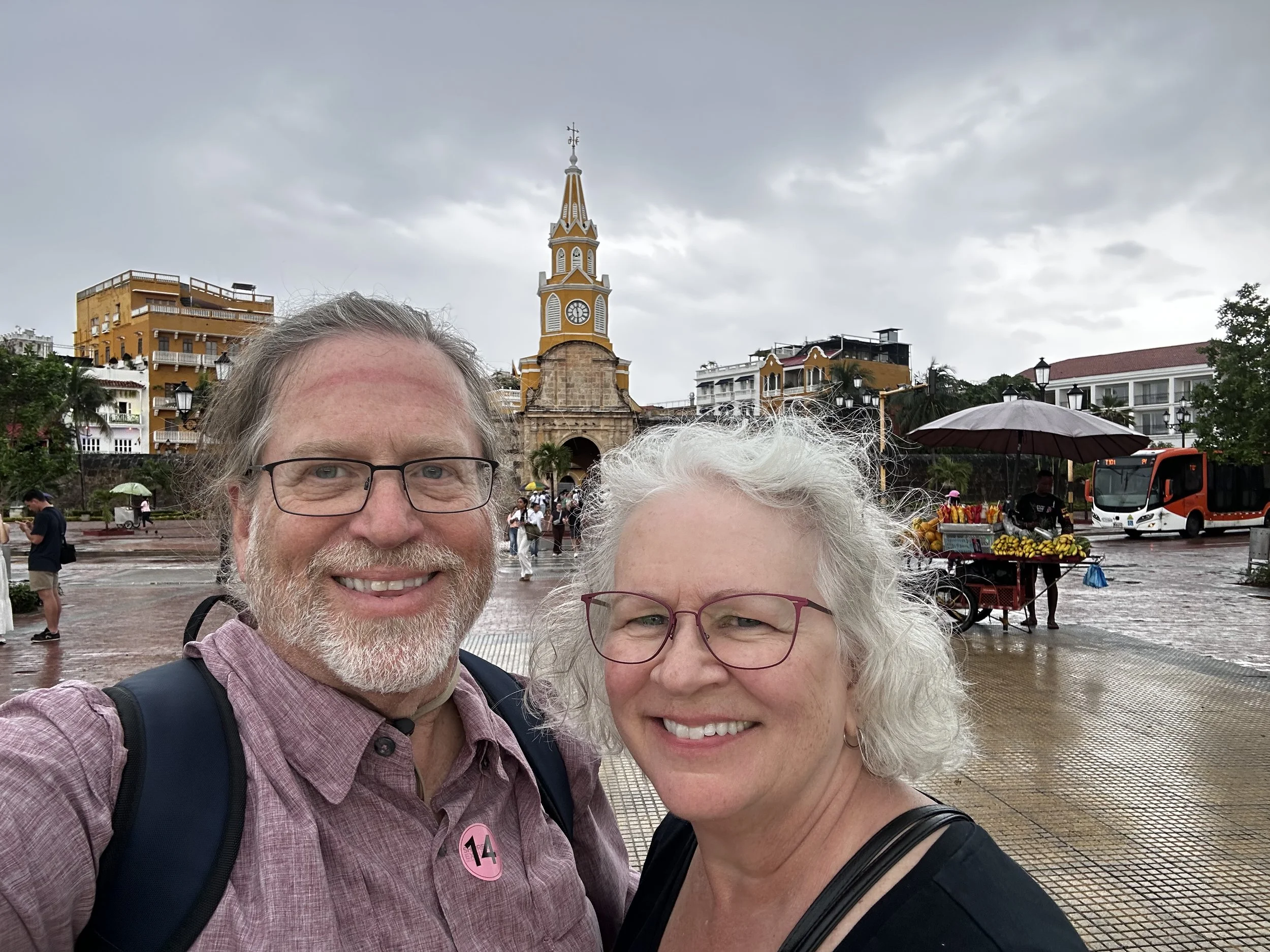
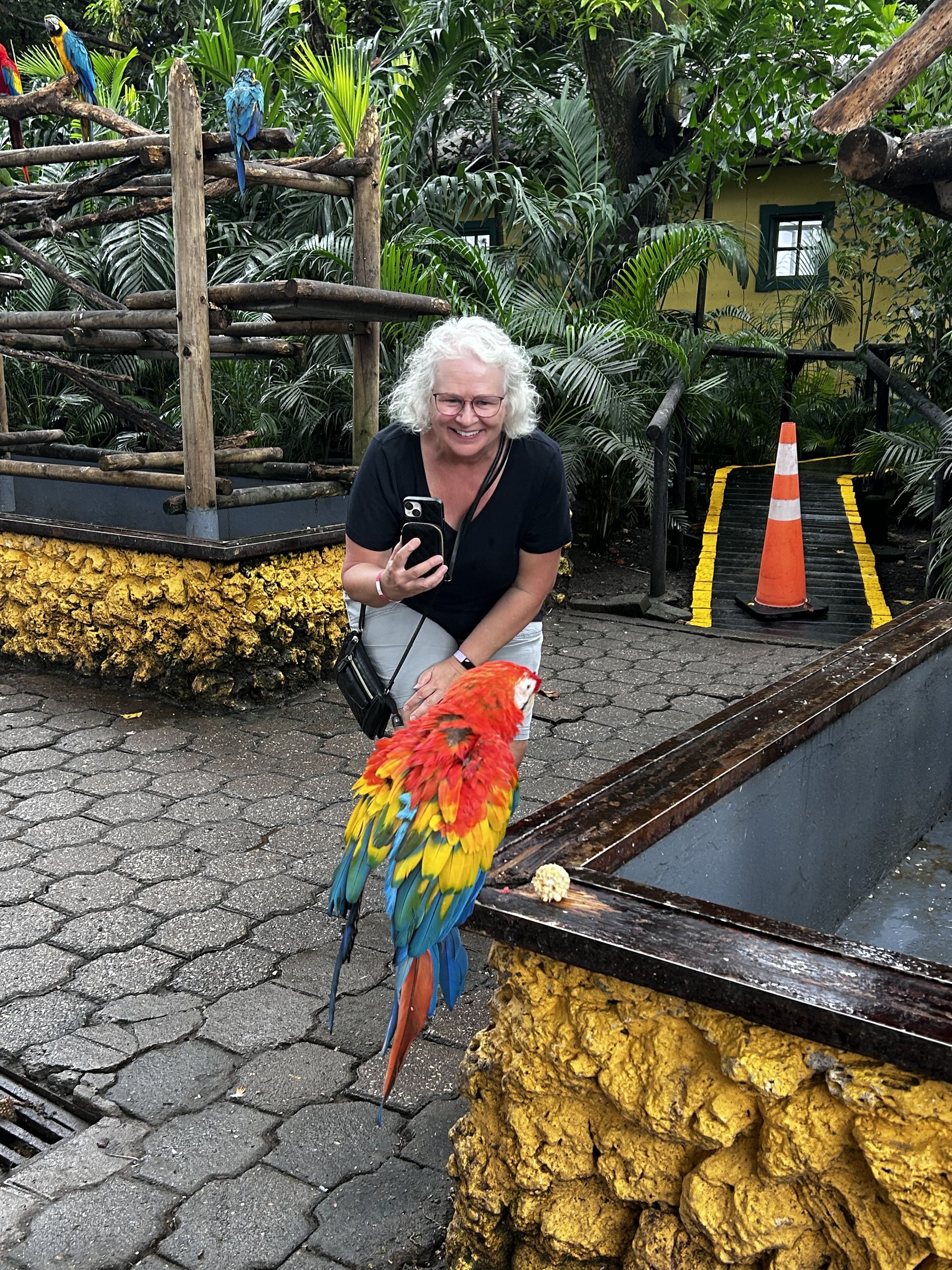
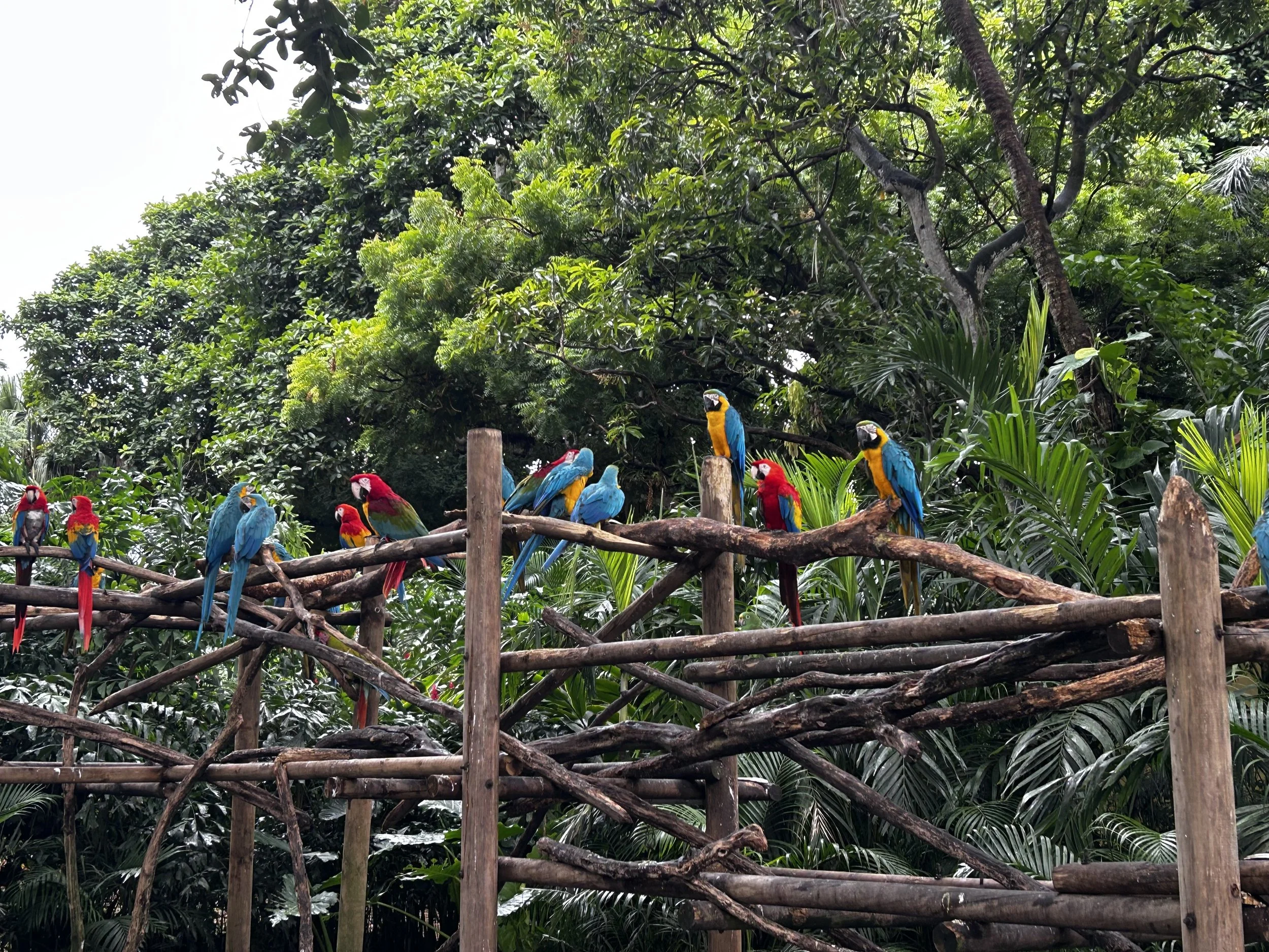
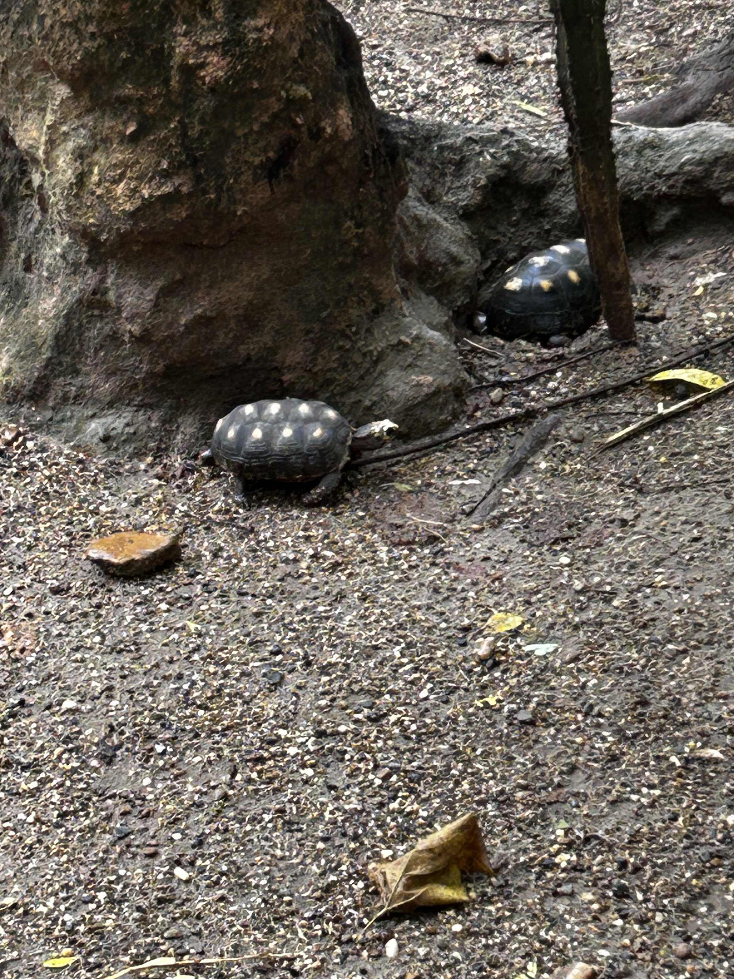
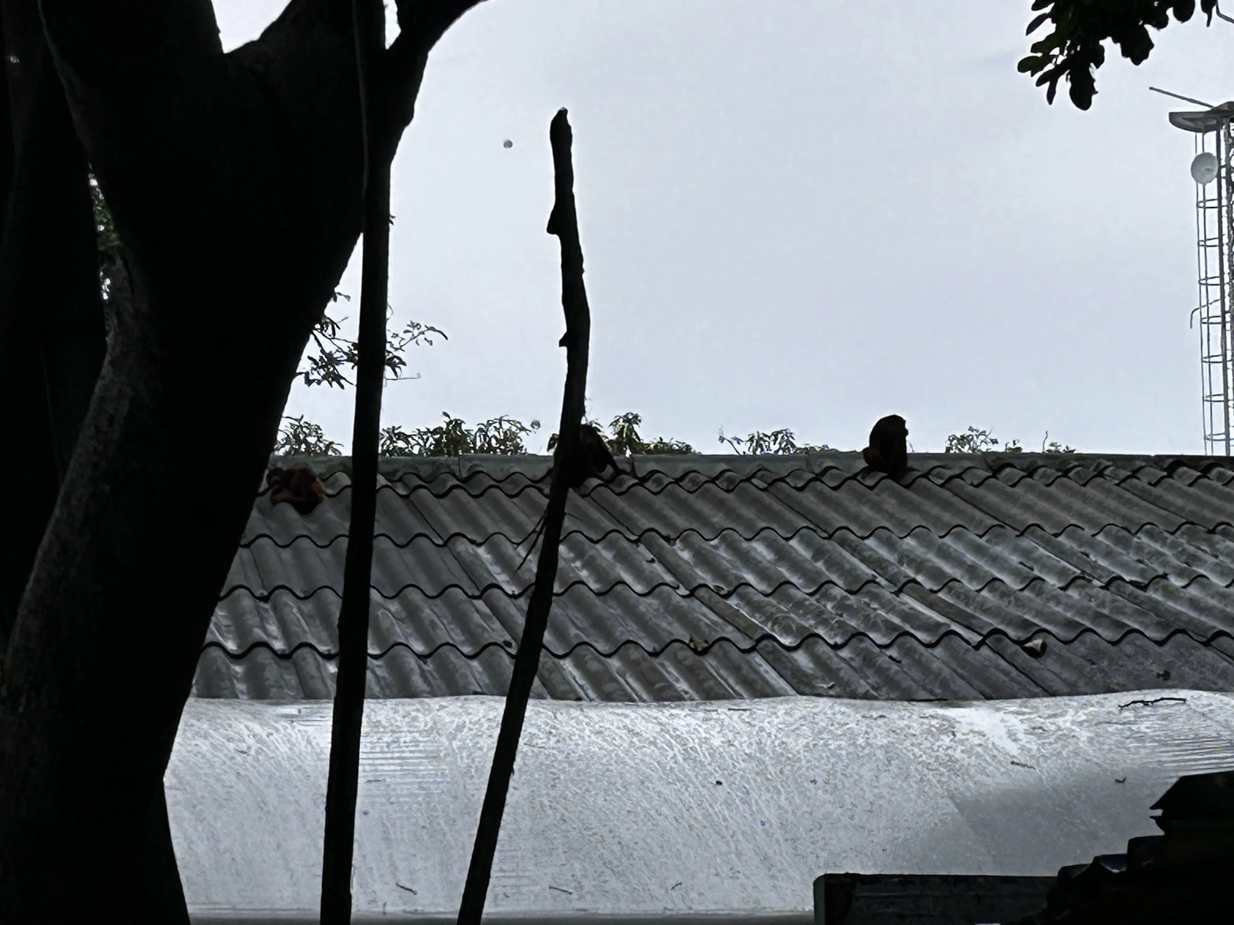
Next stop was Cartagena, Colombia. We did the world’s worse hop-on hop-off tour. The guides were hard to understand, gave conflicting instructions, and they couldn’t get the routes or the stops right. We got off and walked the old city where I bought some of the best coffee in the world, then caught a bus back to the ship. The port entrance had the best part of the city, a wildlife park we had to walk thru to get back to the ship that was teaming with dozens of free-range colorful parrots and flamingos, monkeys, turtles, anteaters, and a sloth. Plus a Juan Valdez coffee shop where I bought more of the world’s best coffee. Actually, the Costa Rican and Colombian coffees are a toss-up. Both are wonderful! My Bride finally drug me back to the ship before I could spend any more of my retirement on bags of coffee.
By the time we got to Grand Cayman and the port at Georgetown, we didn’t do any of the tours and just walked the town. I have to admit I just don’t get that excited about popular locales as I do the out-of-the-way places few visit. But it was a mistake to not engage one of the tours on shore. These are usually a fraction of the cost of the ship arranged excursions, but run the risk that the ship will leave without you if you’re not back at the gangway up posted time. If you are on the ship excursions, they will wait for you, or make arrangements for you to get to the next port. On a small island with 8-10 hours, I figure we can overcome any disaster and still make it back in time. I really didn’t give Georgetown or Grand Cayman much opportunity to impress. I think a tour would have changed that.
Then after a sea day, we arrived at Fort Lauderdale and a flight home. This is our journey from San Diego to Fort Lauderdale thru the Panama Canal. Would I recommend it? YES! But it does take planning. Based on the per-person/per-day rate I use to compare cruise value, this was the cheapest cruise we’ve ever taken! If you catch them right, the repositioning cruises can be a real bargain. And don’t do a Canal for Dummies cruise – enter the Canal and then exit the same way. Do the whole thing! And buy boatloads of coffee in Colombia and Costa Rica. If you do, I know where you can offload some quick, no questions asked!!